Or, Why did thousands of young German men leave the Saxony region of Germany and travel thousand of miles over treacherous seas to an unknown life in an unknown country?
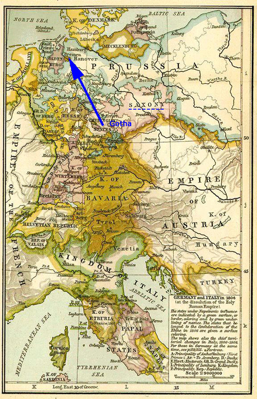
We've talked before about Gotha, Germany being a royal city in Saxony, a position it shared for 6 months of each year with Coburg. We hadn't realized that it had been made a kingdom (rather than a duchy as it had been before) by Napoleon, so let's take another look.
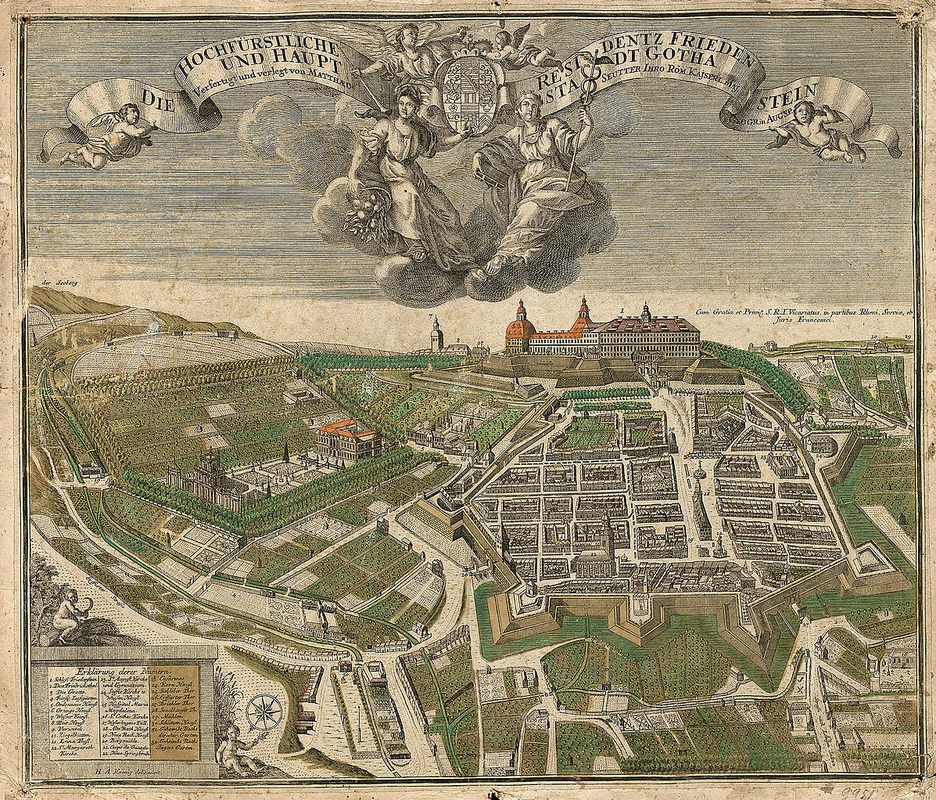
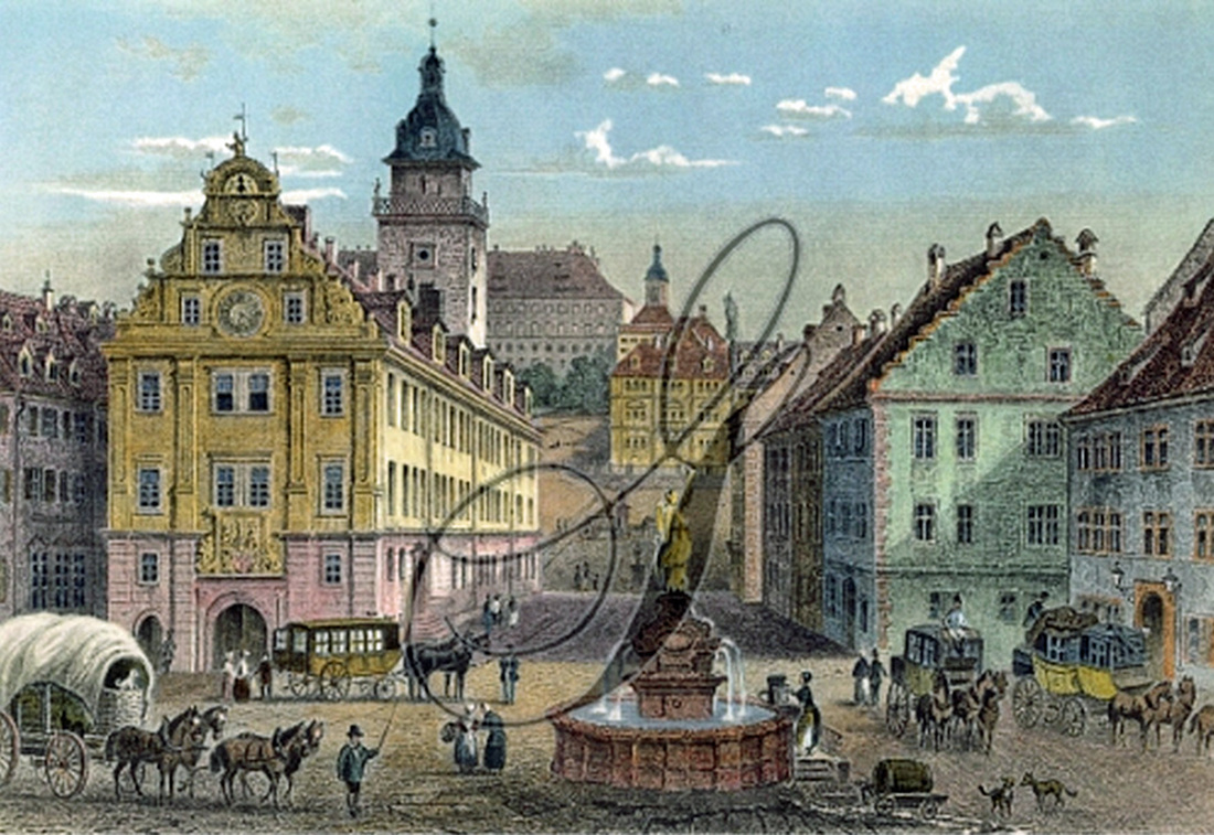
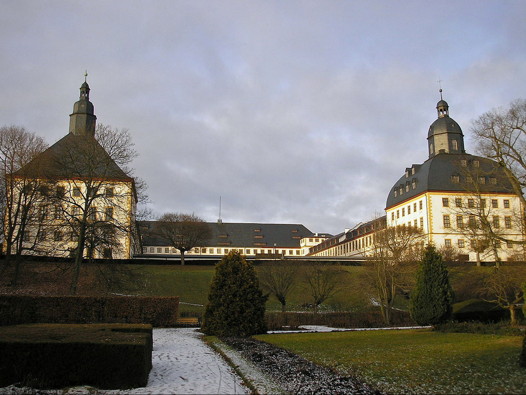
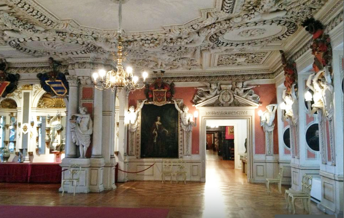
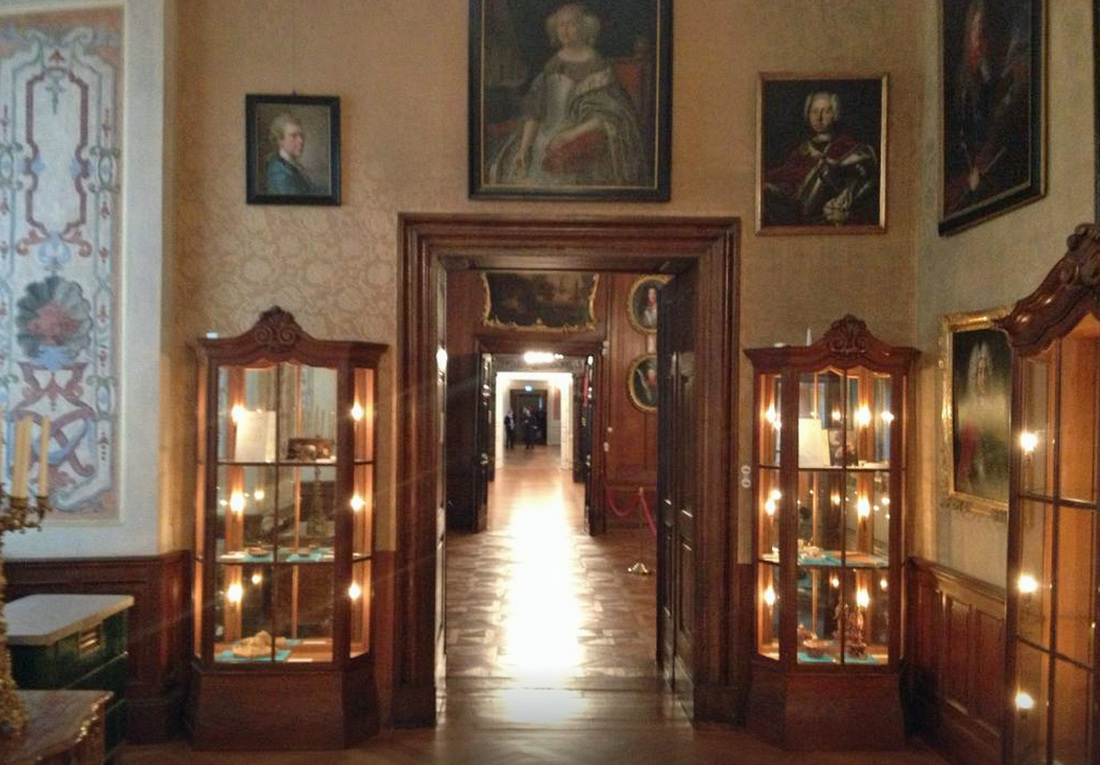
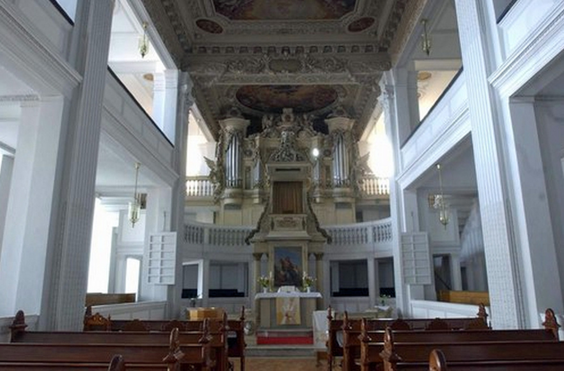
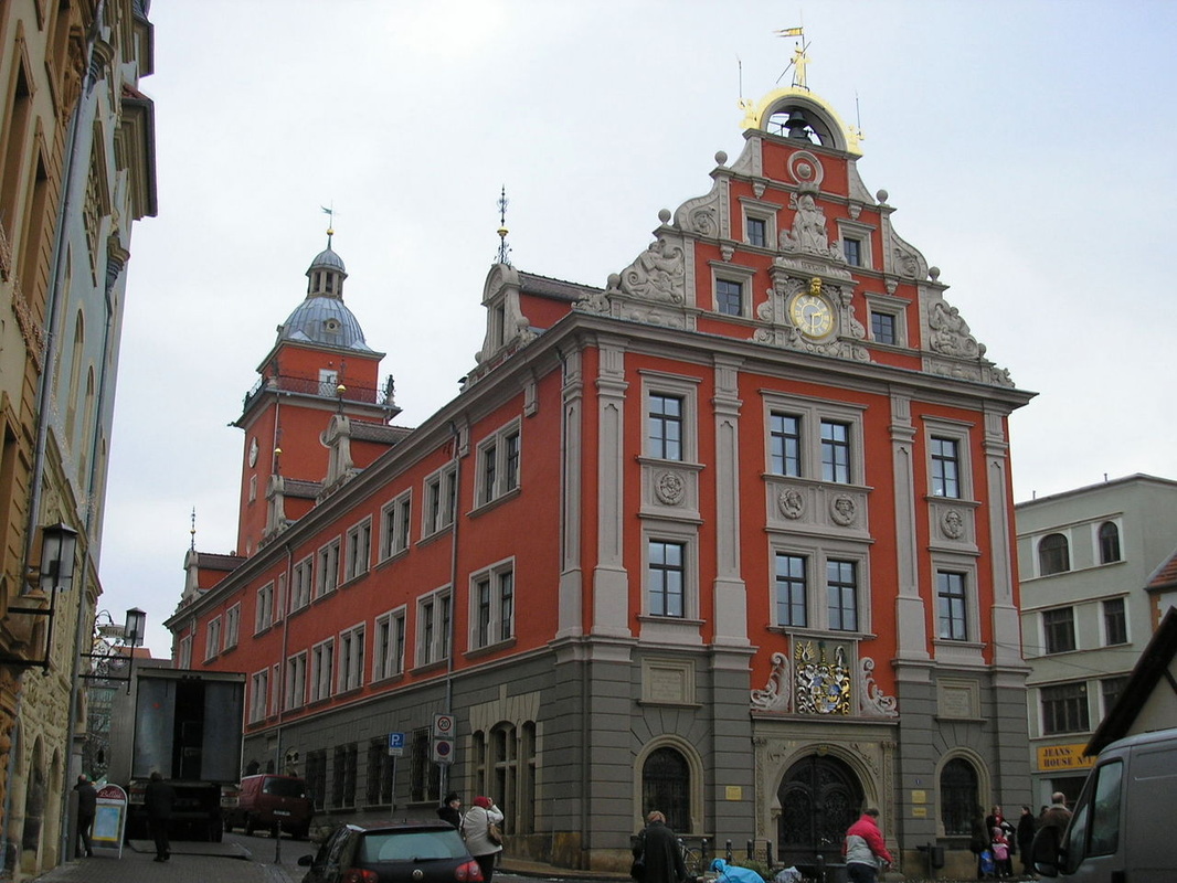
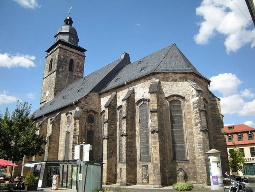
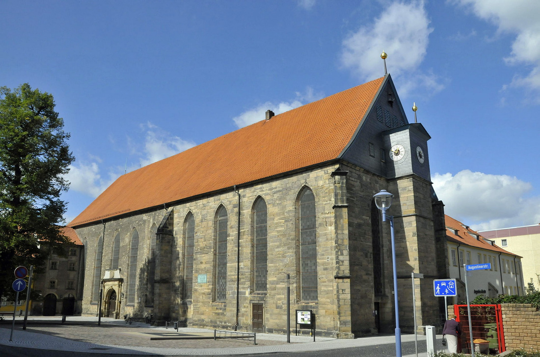
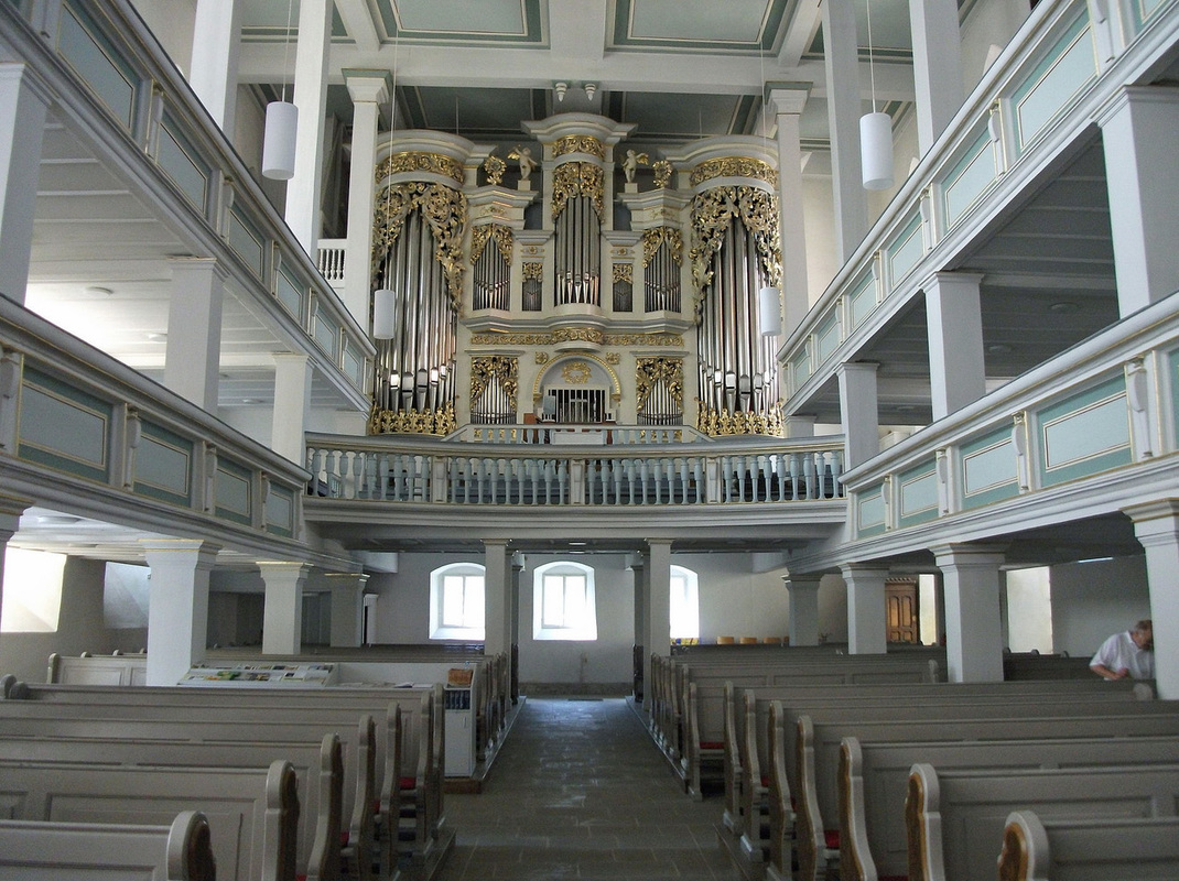
First up is the new 1806 map showing the Kingdom of Saxony, next are the Kings of Saxony (1806 – 1918), then the city in 1730 followed by a watercolour of Gotha in 1850, then the castle (Schloss Friedenstein) exterior and interior pics, lastly the church at the castle (Schlosskirche Friedenstein) where Johann Theodor Wendel Kleinsteuber my 3rd great grandfather was baptised. Other pics are of the Gotha City Hall (Rathaus), and two other churches.
Click on photos to enlarge, cursor over to see caption:
We've talked before about Gotha, Germany being a royal city in Saxony, a position it shared for 6 months of each year with Coburg. We hadn't realized that it had been made a kingdom (rather than a duchy as it had been before) by Napoleon, so let's take another look.
First up is the new 1806 map showing the Kingdom of Saxony, next are the Kings of Saxony (1806 – 1918), then the city in 1730 followed by a watercolour of Gotha in 1850, then the castle (Schloss Friedenstein) exterior and interior pics, lastly the church at the castle (Schlosskirche Friedenstein) where Johann Theodor Wendel Kleinsteuber my 3rd great grandfather was baptised. Other pics are of the Gotha City Hall (Rathaus), and two other churches.
Click on photos to enlarge, cursor over to see caption:


Theodor Kleinsteuber's sons, all 7 of them that lived past childhood, were raised in a middle class environment, Theodor was a Master Shoemaker, had his own shoemaking shop in a good part of the city, and his two eldest sons were also raised as shoemakers.
So, why would the sons leave and go to somewhere totally unknown?
One reason may have been that Saxony had been involved in an unending series of wars over the previous hundred years, first Austria, then Prussia, then France (think Emperor Napoleon), and which, in fact, continued for the next 100 years.
A second reason could have been young men looking for adventure and reading the wonderful stories about free land in a growing country. And, a third reason could have been family dynamics or overcrowding in a small city, perhaps visits to cousins who lived on farms in the neighbouring villages, and so on, no one can be sure.
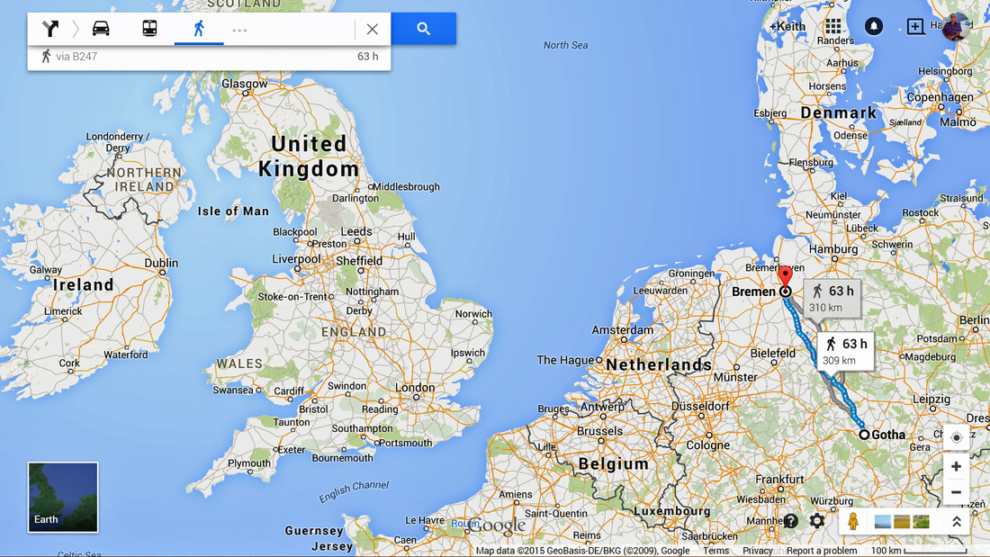
The first part of the journey was the trip from Gotha to the port of Bremen, about 310 kilometers or 192 miles, there were categorically no railways from Gotha before 1857.
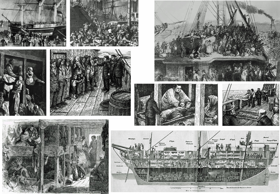
Then, of course, poor people always traveled in steerage, stuffed below decks like livestock and with little or no ventilation, sanitation, or comfort of any kind. The distance from Bremen to New York (as a crow flies) is about 3,800 miles or 6,100 km, so likely closer to 7,000 miles or 11,000 km by sailing ship, and on average took 40 days.
Steerage conditions were deplorable, overcrowded and not sanitary. Water was scarce for cooking and drinking let alone bathing, and many were not allowed on deck for sunlight and fresh air. Many of the passengers were suffering from fever and disease and in the 1840s and 1850s, it would have taken the sailing ship between 21 to 42 days to reach New York. Conditions in steerage were barely improved as steam ships took over, but the voyage became 10 to 12 days.
Click on photos to enlarge, cursor over to see caption:
So, why would the sons leave and go to somewhere totally unknown?
One reason may have been that Saxony had been involved in an unending series of wars over the previous hundred years, first Austria, then Prussia, then France (think Emperor Napoleon), and which, in fact, continued for the next 100 years.
A second reason could have been young men looking for adventure and reading the wonderful stories about free land in a growing country. And, a third reason could have been family dynamics or overcrowding in a small city, perhaps visits to cousins who lived on farms in the neighbouring villages, and so on, no one can be sure.
The first part of the journey was the trip from Gotha to the port of Bremen, about 310 kilometers or 192 miles, there were categorically no railways from Gotha before 1857.
Then, of course, poor people always traveled in steerage, stuffed below decks like livestock and with little or no ventilation, sanitation, or comfort of any kind. The distance from Bremen to New York (as a crow flies) is about 3,800 miles or 6,100 km, so likely closer to 7,000 miles or 11,000 km by sailing ship, and on average took 40 days.
Steerage conditions were deplorable, overcrowded and not sanitary. Water was scarce for cooking and drinking let alone bathing, and many were not allowed on deck for sunlight and fresh air. Many of the passengers were suffering from fever and disease and in the 1840s and 1850s, it would have taken the sailing ship between 21 to 42 days to reach New York. Conditions in steerage were barely improved as steam ships took over, but the voyage became 10 to 12 days.
Click on photos to enlarge, cursor over to see caption:

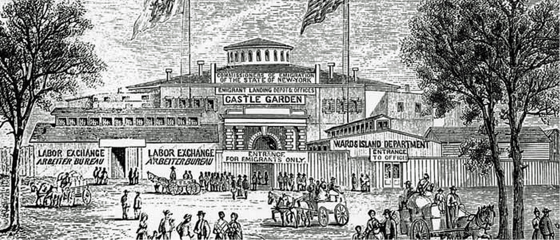
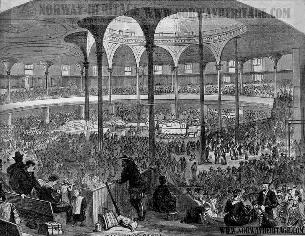
We're not sure how immigrants to Canada got there from New York in the 1840s and early 1850s, they likely took another ship to Montreal, then a lake boat to Kingston. In 1856 a railroad line was completed from New York to Cape Vincent and there was a ferry service across to Kingston. In 1859 a railroad line was completed between New York and Montreal, and by 1856 there was regular rail service between Montreal and Toronto (with stops in Kingston and Belleville).
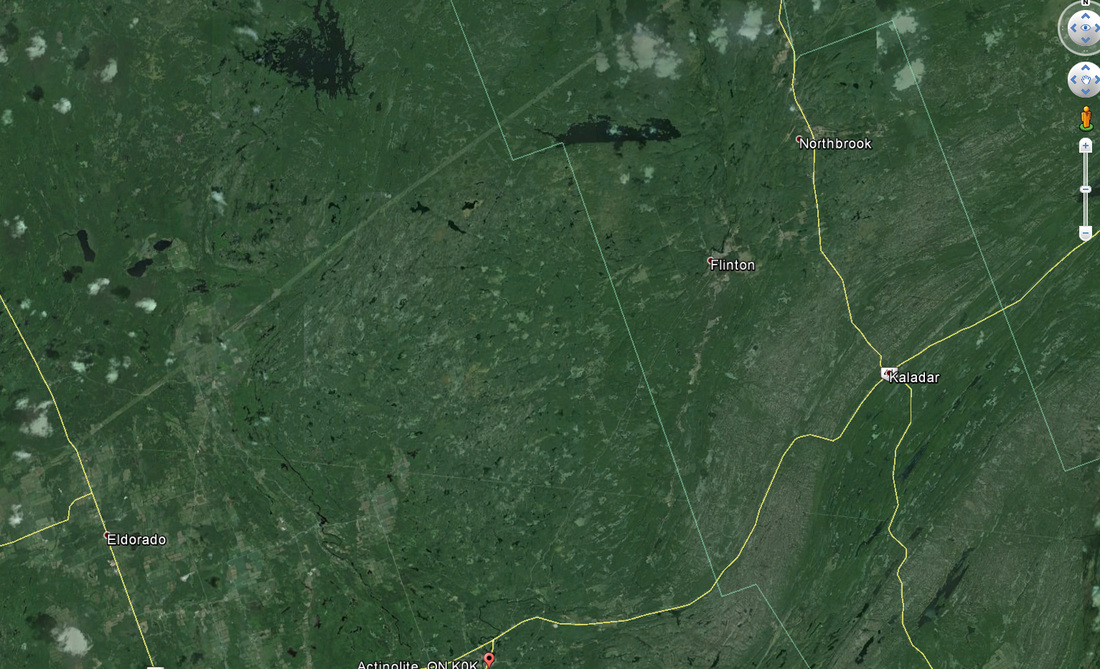
So – our citified shoemaker ancestors had made it as far as Kingston, and we'll look at the map for a moment. In 1755 the entire population of Canada was 90,000, the large majority being east of the current Ontario border with Quebec. During the 1770s and 1780s, some 50,000 United Empire Loyalists came to Canada, with close to 10,000 settling in Ontario, the largest percentage of those in Eastern Ontario.
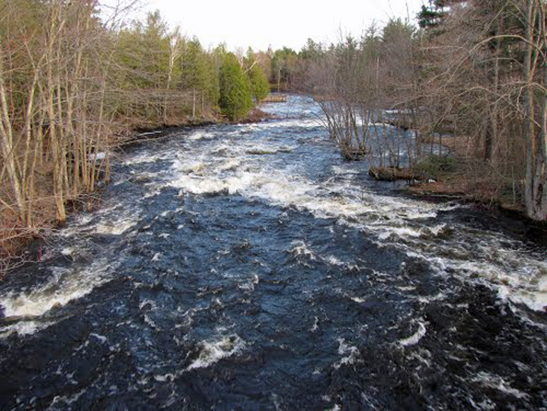
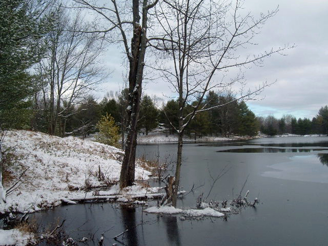
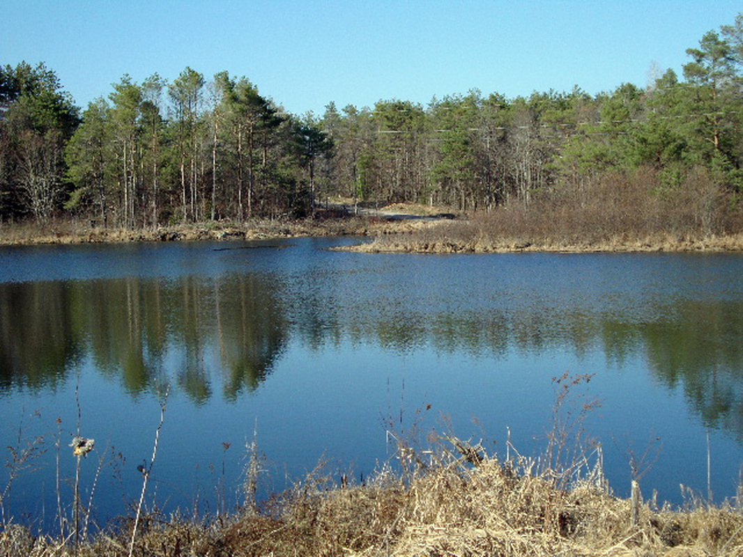
If we look at the map, we can see where Highway 401 crosses east to west, and the beast farmland in eastern Ontario is south of that line, rich alluvial soils deposited and left behind after the last ice age about 10,000 years ago. Our UEL cousins were each (incl. children and wives) 200 acres each or about 81 hectares, and most of this land was south of Hwy 401. The area between 401 and the east west highway # 7 is much less arable, with many swamps, small lakes, and rocky outcroppings – and this is mostly where the tens of thousands of Irish refugees during the potato famine in the 1840s ended up, given about 160 acres each IF they constructed a liveable habitation and had a certain amount of land cleared and planted in the first 2 years.
The land to the north of highway 7 was the southern edge of the great Canadian Shield with almost no arable land at all, forests, swamps, rivers, a myriad of small lakes, rock outcroppings, and black flies the size of starlings (well, almost seemed that way!).
In the general view of the land area they were given, do you see anything here that looks like arable land? Lots of water, rock, and trees! Same with a more specific view of the land area they were given.
Click on photos to enlarge, cursor over to see caption:
So – our citified shoemaker ancestors had made it as far as Kingston, and we'll look at the map for a moment. In 1755 the entire population of Canada was 90,000, the large majority being east of the current Ontario border with Quebec. During the 1770s and 1780s, some 50,000 United Empire Loyalists came to Canada, with close to 10,000 settling in Ontario, the largest percentage of those in Eastern Ontario.
If we look at the map, we can see where Highway 401 crosses east to west, and the beast farmland in eastern Ontario is south of that line, rich alluvial soils deposited and left behind after the last ice age about 10,000 years ago. Our UEL cousins were each (incl. children and wives) 200 acres each or about 81 hectares, and most of this land was south of Hwy 401. The area between 401 and the east west highway # 7 is much less arable, with many swamps, small lakes, and rocky outcroppings – and this is mostly where the tens of thousands of Irish refugees during the potato famine in the 1840s ended up, given about 160 acres each IF they constructed a liveable habitation and had a certain amount of land cleared and planted in the first 2 years.
The land to the north of highway 7 was the southern edge of the great Canadian Shield with almost no arable land at all, forests, swamps, rivers, a myriad of small lakes, rock outcroppings, and black flies the size of starlings (well, almost seemed that way!).
In the general view of the land area they were given, do you see anything here that looks like arable land? Lots of water, rock, and trees! Same with a more specific view of the land area they were given.
Click on photos to enlarge, cursor over to see caption:


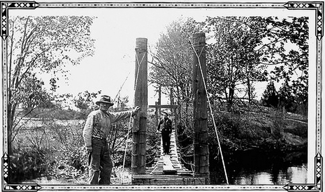
Well, today the area has returned to nature and there is a campground where Henry and John Henry Lorenz Kleinsteuber first arrived. But here's what they saw when they first arrived.
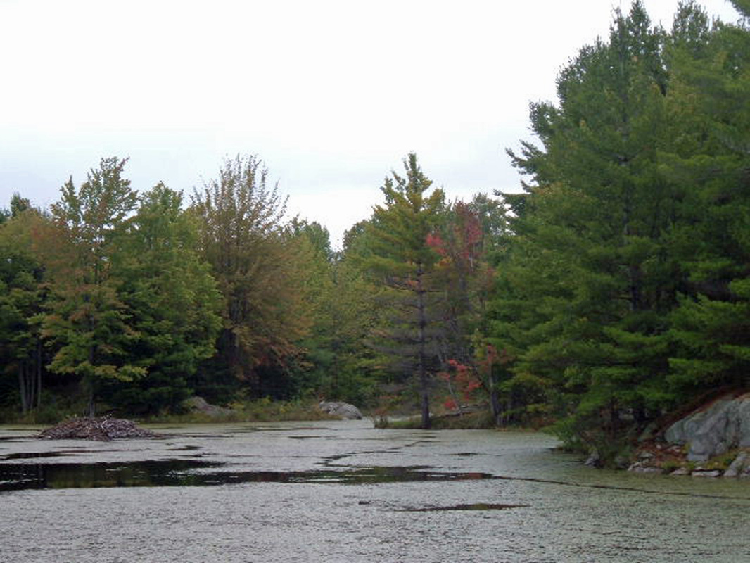

So they probably cut trees down and built a lean to shelter to start, started to clear land for gardening, and they likely both started peddling their shoe making expertise in the booming village of Bridgewater, only 4 kilometers away (now known as Actinolite) with a population of several hundred people.
And it is likely in Bridgewater where they charmed the daughters of UEL descendants who all had large families. John Henry Lorenz married Annie Youmans, who had 11 siblings and 6 aunts and uncles who all had large families. We think they helped build the first actual homes for the 2 Kleinsteubers, and they likely looked like this.
As time went by, more of the Kleinsteuber siblings immigrated from Germany, including their mother in 1867 after their father, Theodor, died of Cholera in 1866. They all worked together to clear land, build homes, and raise families. This area became known as the German Settlement.
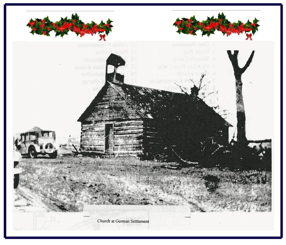
The entire family had been raised as Evangelical Lutheran, and the brothers built their own log church, which was used until the 1930s. Neighbours said on a frosty December night they could hear the Kleinsteubers singing German Christmas Carols from a mile away.
As time went on, the next generation gradually moved away to areas with better soil, or more urban areas with better job opportunities for their children.
Click on photos to enlarge, cursor over to see caption:
And it is likely in Bridgewater where they charmed the daughters of UEL descendants who all had large families. John Henry Lorenz married Annie Youmans, who had 11 siblings and 6 aunts and uncles who all had large families. We think they helped build the first actual homes for the 2 Kleinsteubers, and they likely looked like this.
As time went by, more of the Kleinsteuber siblings immigrated from Germany, including their mother in 1867 after their father, Theodor, died of Cholera in 1866. They all worked together to clear land, build homes, and raise families. This area became known as the German Settlement.
The entire family had been raised as Evangelical Lutheran, and the brothers built their own log church, which was used until the 1930s. Neighbours said on a frosty December night they could hear the Kleinsteubers singing German Christmas Carols from a mile away.
As time went on, the next generation gradually moved away to areas with better soil, or more urban areas with better job opportunities for their children.
Click on photos to enlarge, cursor over to see caption:

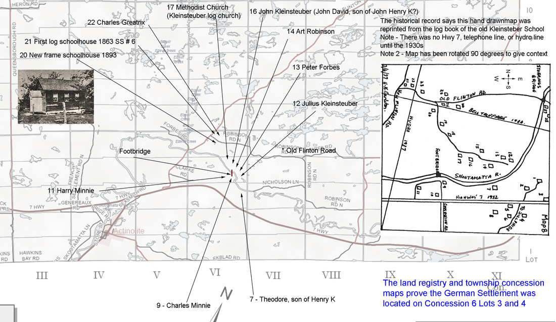

And even today, more than 150 years later, we can still see the vague outlines of all the fields that were cleared to try and grow crops in this inhospitable environment. The green lines show the three 160 acre lots that were involved in the German Settlement, the yellow deltas indicate the fields that were cleared in the mid 1800s and that have returned to nature, and the yellow asterisk is where we believe Henry Kleinsteuber's house was located.
The general area and the former location of the German Settlement is now a popular tourism area in the summer, and my ancestors would likely roll over in their graves if they knew a Gay campground was located on their property. One of the owners, Derek, is a charming guy, and he is convinced the ghost of John Henry Lorenz visits the grounds regularly, and Derek has told me several stories of the spooky things that have happened.
The general area and the former location of the German Settlement is now a popular tourism area in the summer, and my ancestors would likely roll over in their graves if they knew a Gay campground was located on their property. One of the owners, Derek, is a charming guy, and he is convinced the ghost of John Henry Lorenz visits the grounds regularly, and Derek has told me several stories of the spooky things that have happened.
